Hi Flite
![]()
![]()
![]()
![]()
![]()
![]()
![]()
![]()
![]()
![]()
![]()
![]()
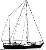
St. Petersburg to Marathon
The Plan:
We needed to have the boat in Marathon before December 16th. Cori was not available for this leg of the trip. Fortunately our friends Larry and Jean were arriving in Key West in time for Larry to join me on the first leg. He joined me in Treasure Island to finish off the preparations and provisioning. Our plan was to go out for a shakedown cruise on Sunday and leave on Monday arriving in Marathon on Wednesday.
Reality:
Checking the weather there was cold front that was supposed to move in on Tuesday with some high winds and waves. Leaving Monday would have put us out in the Gulf or Florida Bay when this front went through. It was decided that we would leave on Sunday to beat the front. The only problem with this plan was that there is some shoaling near the marina we were in and to get out we had to wait until high tide. At high tide, about 3:00 p.m. we started out. Immediately we hit the shoal in the wrong spot and were aground. After backing off we tried another spot and bumped our way into the waterway and were on our way to Johns Pass Inlet. We had two options for getting to the pass, one was follow the markers around a small island or follow a shorter route George showed me. I guess I didn't pay real good attention when I was with George and I got a little out of the channel and started bumping the bottom again. We made it out of the pass without a problem, got the sails set and turned out of the channel for our run south. The forecast was for 10 - 15 knot winds out of the NW, perfect for what we had planned.
On our Way:
As soon as we made our turn south we lost our wind. We tried sailing until our speed dropped under 4 knots. At this point we decided to motor-sail. This technique involves leaving the main sail up and using it for a little lift while you motor. I had planned out our route using the navigation software on the laptop. The GPS interfaces with the software so it is easy to follow the route you planed and will let you know if you are getting off track. We started our log, recording latitude, longitude, speed, course and a few other things every hour on the hour. Our first waypoint was buoy #9 marking the entrance to Tampa Bay. At this point we found the accuracy of the software, GPS and auto pilot. We literally had to alter course to avoid hitting the buoy.
As it was getting dark we started our watch rotation. We decided to try two hour watches, the idea that shorter would be easier. At this time the wind had died completely and we dropped the main and motored with out the sails. We didn't need the sails for the rest of the trip to Marathon. We were now a motorboat with two tall masts going six knots per hour.
Alternate plans:
We motored through the night rotating watches every two hours. The west coast of Florida was still within sight and watching the lights and checking the charts told us where we were. One of our concerns was that by leaving late on Sunday and maintaining six knots we would arrive in Marathon during the night. Night arrivals in a port you are not familiar with is a bad idea. One of the advantages of the software we were using is the ease that you can make new routes changing your plans and looking at other options. We spent some of the time on the trip looking for options to a night arrival and planning bail out points in case things didn't continue going well. It was decided that we continue on and make a stop or slow down to change our arrival time.
We saw a few of boats along the way, mostly fishing vessels, but one cruise ship leaving Tampa Bay looking like it had every light on board turned on. The only wildlife on the trip was one sea turtle that surfaced by us.
Bump in the night:
We continued on the next day without incident and into the next night. During the night we hit something. We stopped, checked the bilge, checked the engine and prop to see if anything was our of order. We were able to motor forward and reverse without vibration and were not taking on water. To this day we do not know what it was. We thought it may have been a lobster pot that hooked on to us and bumped the bottom of the boat since there were a lot of them in the area. It may have been another turtle, or it may have been an alien space ship, we will never know. I did dive down while in Marathon to check if anything was fouled on the prop or shaft but found nothing.
Florida Bay:
Eventually we cleared Cape Sable and entered Florida Bay. We were still motoring with the auto pilot steering and doing two hour watches. We started to see the lights from towers on the Keys. At this point we were very tired. Two hour watches did not let us get enough sleep to feel rested. We came to the conclusion that two hours was not a very good idea. As we watched the lights and checked our charts we decided that things did not make a lot of sense and now would be a good time to stop and wait for daylight. This solved several problems - we would get three to four hours of sleep, we would arrive in the daytime, and things always look differently in the daytime.
Stopping at this time was not a problem, we hadn't seen another boat all night and we were in about 19 feet of water. We dropped anchor and crashed in our bunks. About 6:00 a.m. Larry woke me up with the announcement that "we are aground". A boat at anchor will point itself into the wind. Larry noticed that the wind was from off the port side rather then the bow. The depth meter said that we had plenty of water below us and when I tried motoring we moved easily with no bumping. It turned out that the current was overpowering the wind and we were pointing into the current rather then the wind. As a couple of Lake Superior sailors we were not used to the effects of a current. We hoisted the anchor and started on our way again feeling a lot better.
Once we got going we became aware of the number of lobster pots we were in. They were laid out in grid patterns as far as we could see. It amazed us that we had not had a problem with them during the night. Now that we could see them we started having to avoid them. One of us had to be at the wheel to alter course when one of them was directly ahead of us.
Approaching Marathon:
As we got closer to Marathon we started having day markers to navigate through the channels. Also there was another sailboat on a different coarse that would cross our path and it was possible they had a better idea where they were going then we did. It became apparent the they knew less then us when they turned to follow us. Unfortunately I got my markers mixed up. The marker that I was sure we were to pass close by then turn 45 degrees to starboard was the marker we were to stay off of due to shallow water. Once again we were aground, this time with another boat following close behind. Larry called the other boat to warn them not to follow and they turned off and decided to go their own way. Their way must have been good since they arrived in Marathon before us. Once again we were able to back off the sandbar and continued. Following the markers we proceeded to the inner channel and we approached the Seven Mile bridge that marks the change from The Gulf of Mexico to the Atlantic Ocean.
Boot Key Harbor:
Once under the bridge and turning to Boot Key Harbor we needed to find a spot to anchor. Boot Key Harbor can easily hold several hundred boats at anchor. Shortly after entering the harbor we picked a spot and dropped the hook. As we settled in I was not sure we had that good of a spot. We were very close to the channel if not actually in it. At this time I was able to convince Larry to pull anchor and go looking for a better spot. As we started motoring through the harbor we crossed an open area with the usual effect. It became obvious why no one was in this area and we were aground once again. We saw a guy on a nearby boat waving and trying to get our attention. He fired up his dinghy and came over to give advice on where to go. We were informed that we were the third boat that day that tried to cross there. It was decided that we were best off going back to our original spot but moving further ahead to avoid the channel and dropped the anchor. We were right on schedule arriving Tuesday afternoon. Jean drove up to pick up Larry and I was alone on board again.
Weather:
The weather for the trip was forecast for 10 - 15 knots. We saw more perfectly flat water then we had ever seen and not a breath of wind. The entire trip was done under motor. The cold front that was forecast came through on Wednesday with the expected high winds, not something I would like to have been caught out in. After that everything settled down and it was a pleasant stay while waiting for Cori to join me.